How to Not Get Lost on the Trail

Make me to know your ways, O Lord; teach me your paths.  ~Psalm 25:4 (ESV)

On one of our many day hiking trips to the Red River Gorge Geological Area in Daniel Boone National Forest, we encountered a couple at the trailhead who were on a multi-day backpacking trip.  As we were loading gear into the car after our hike, a man approached us seemingly to ask for directions.  After a brief discussion it turned out he and his wife were hoping to get a ride because they had taken a wrong turn on the trail and were now three miles off their intended route, and around eight miles from their vehicle.  We happily gave them a ride, and our conversation on the drive inspired me to post a few thoughts on how to not get lost on the trail.
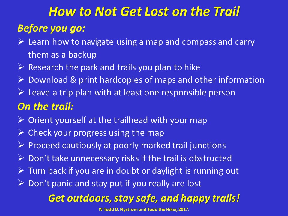
Before You Go:

Learn how to navigate using a map and compass and carry them as a backup:  With today’s amazing GPS technology and the availability of some excellent smart phone apps, many people rely exclusively on these devices.  As much as I am a fan of digital technology, there are limitations:  batteries run out, devices break, software fails, and GPS signals can be obscured by weather, rough terrain, and heavy foliage.  For these reasons I strongly recommend learning how to read a topographic map and navigate using a magnetic compass and carrying both as a backup especially when exploring more rugged and remote areas.  There are plenty of good books to get you started, but hands-on experience is important if you ever have to count on these skills.  Check with a local park, outfitter, or hiking club to see if they know of classes available in your area, or if you live near an REI store they typically offer a Map & Compass Navigation Basics course several times a year.

Research the trails and parks you plan to hike:  Research is amazingly easy with many helpful park websites, well written blogs, online guides, and even a number of free online sources for USGS topographic maps.  One of the most important things to understand before loading up your gear and heading to a new destination is the difficulty of the trails and terrain you will face so you show up prepared with appropriate maps and trail guides.  In parks with good signage and well-blazed, easy-to-follow trails, a simple overview map showing roads, trails, facilities, and a few geographic features may be sufficient.  But, in rugged terrain with twisting, turning, or poorly marked trails, a detailed topographic map and possibly a descriptive trail guide may be necessary.

Although visitor centers and park offices are usually a great source for maps and information, do your homework rather than just showing up.  Hours of operation can be unpredictable and many isolated or smaller parks close facilities in the off season, while some have no facilities at all.  Also, some parks require reservations or advance purchase of permits, especially for overnight stays, and may require you to check-in when you arrive.  Knowing and preparing for these things ahead of time will avoid disappointment later.

Map Detail Comparison

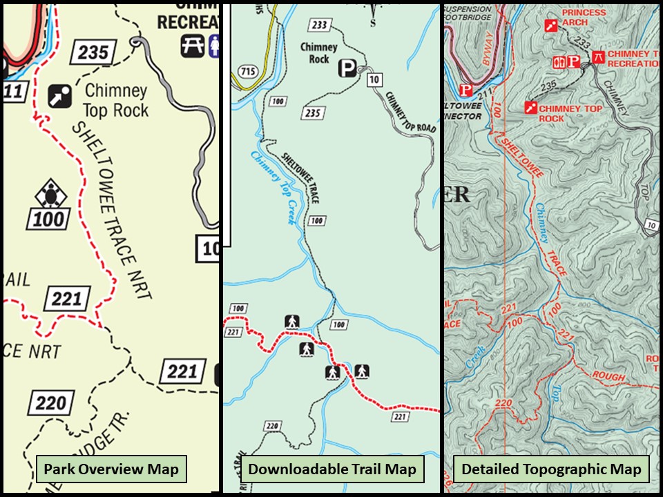
Three maps of the same area in Red River Gorge showing different levels of detail.

Download and print hardcopies of maps and other information:  You can likely find everything you need online, but make sure you download it to your devices before you go as cell service may be limited or non-existent on the trail.  Even if you are using your electronic devices as your primary navigation tool, print and carry hardcopies as a backup.  I am a big fan of physical maps and guide books; but, rather than bringing the whole map or a toting a heavy book in my pack, I make copies of the sections and pages needed, seal them in a zip-top bag to keep them dry, and carry them in a pocket so they are easily accessible on the trail. Personally I prefer using a paper topo map as my primary navigation tool as it gives a broader perspective than the confines of a phone or GPS screen.

Map sections and guide book pages ready for the trail.

Leave a trip plan with at least one responsible person:  Not every hike requires extensive planning, but the further you venture away from civilization and the longer you plan to be out, the more intentional you need to be.  Even on short day hiking trips with minimal preparations, it is good to let at least one responsible person know where you are going, who you are with, the trail(s) you intend to hike, and when you expect to be home.  On longer trips let two or three people know, and include more details, like vehicle information, local agencies to contact, and a daily itinerary with trailheads, routes, and specific campsites if possible.  An easy way to send all this info is by marking up a map with these details and attaching it to an email.  Taking the time to prepare a thorough trip plan helps familiarize you with a new area, which is helpful in keeping you from getting lost, but more importantly, by sharing it with someone else, it will help rescuers find you if something does go wrong.  Just make sure you contact everyone after you return home or if you decide to extend your trip so they don’t get concerned and start alerting the authorities.

Trip Plan Example

Example trip plan with detailed maps.

On the Trail:

Orient yourself at the trailhead with your map:  Once you arrive at the trailhead, take a few minutes to look at the map and orient yourself as things tend to look different in person than they do on a screen or in a book.  Start by finding the trailhead on your map.  As ridiculously simple as this sounds, I have actually run into quite a few people on the trail who asked for directions and were not sure where they started their hike, not a good position to be in if you find yourself lost or in need of help.  After you know your starting point, study the trails you will be hiking, as well as nearby trails, especially those intersecting your route.

Next, identify major, extended geographic features in the area such as roads, rivers, and ridgelines.  When paralleling your route, these features are called “handrails,” and when perpendicular to your route they are called “backstops.”  These features are helpful to keep you oriented along the way, but also provide easy-to-find destinations to navigate toward if you get turned around.

IMG_0243

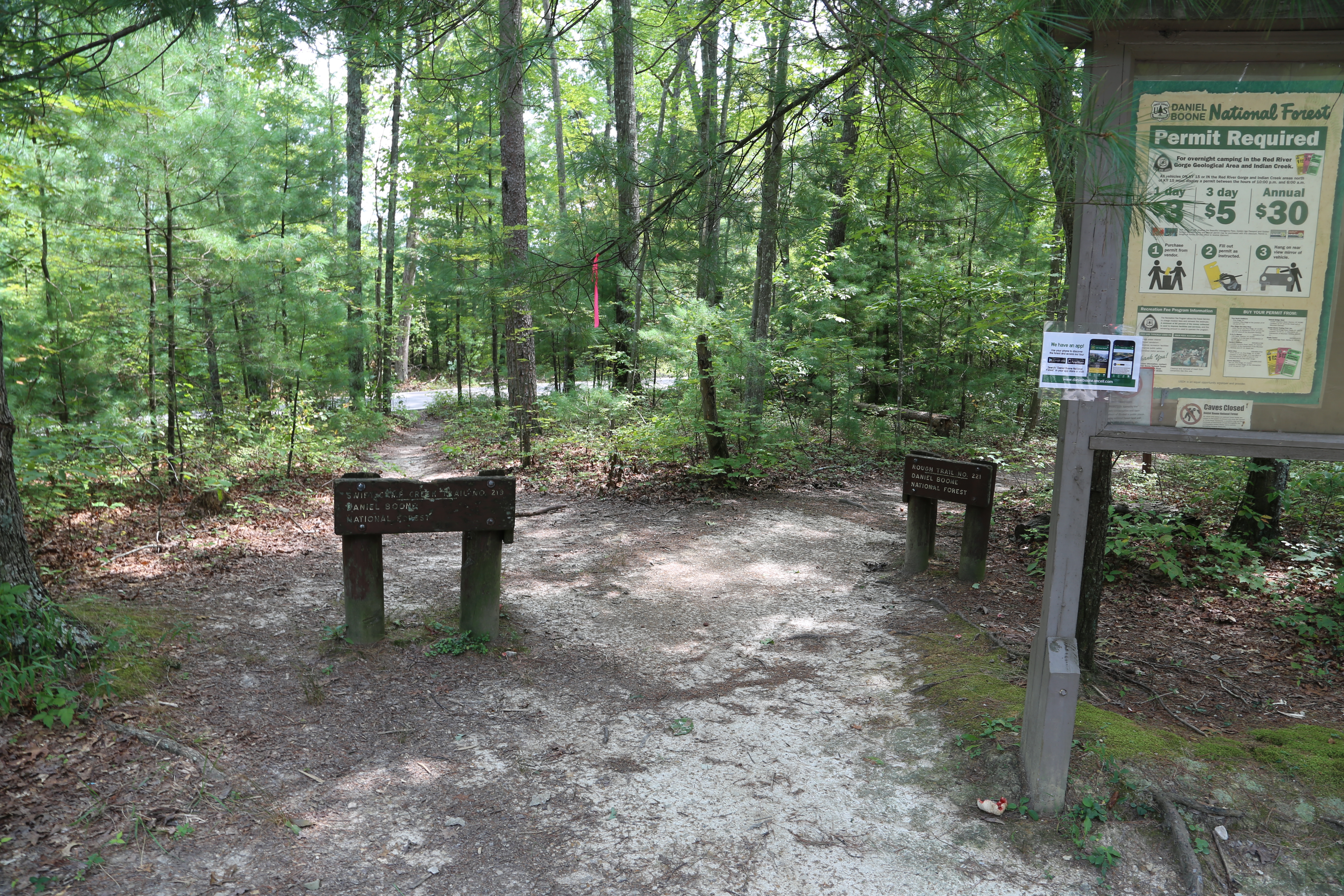
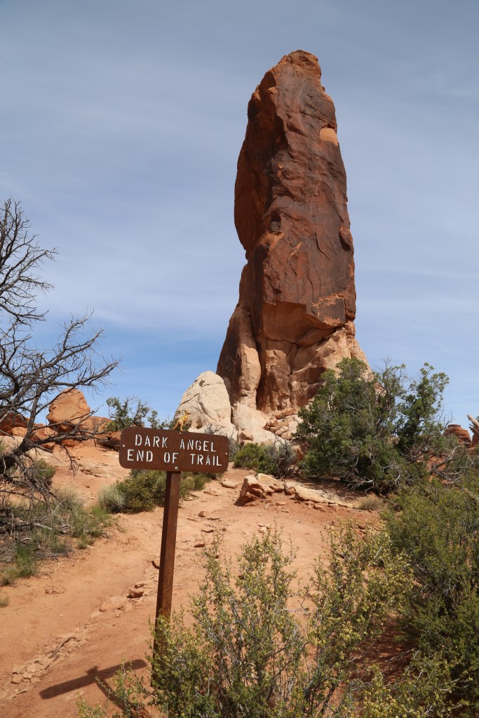
Rough Trail (#221) trailhead in Red River Gorge.

Check your progress using the map:  As you hike periodically check your progress against the map.  Pay close attention at trail junctions and always be on the lookout for distinctive landmarks such as prominent bends in the trail, high points like peaks, ridges, and cliffs, and low points like ravines, creeks, and lakes.  It is also good to look behind you on occasion as another means to stay oriented.  Even on a loop trail this could prove useful if you ever need to backtrack.  Paying attention as you go and noting each point on the map ensures you will never be too far off your desired path at any given moment.

Proceed cautiously at poorly marked trail junctions:  There are situations where extra precaution is warranted.  Areas with poorly marked or numerous unofficial trails can be particularly difficult.  Also, be aware that signs and markers are sometimes damaged by weather or vandals.  If you end up at a questionable trail junction, proceed with caution and use your map and compass to determine which path coincides with the direction you are traveling.  After choosing a route, proceed a short distance and look for trail blazes (or cairns in some environments), signs, or recognizable terrain features.  If you find a clear indictor that you are on the right path press on, but if nothing appears or the trail starts to fade, return to the trail junction and try a different direction.  If you find yourself at a particularly confusing trail junction be sure to mark the direction you came from in a non-destructive fashion to help you backtrack if you do not find a clear way forward.

IMG_7016

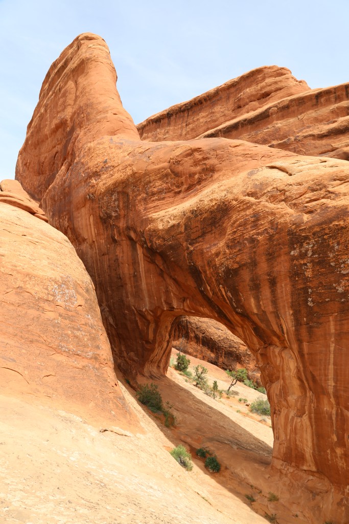
Weathered trail marker on Buck Trail (#226) in Red River Gorge.

Don’t take unnecessary risks if the trail is obstructed:  Another situation demanding extra precaution is when you encounter obstructions on the trail such as creek crossings, blown down trees, slides, or wash outs that require you to detour around.  If an obvious path is not evident take your time looking for a safe and clear way through, but don’t venture too far and risk losing the trail completely.

IMG_7357

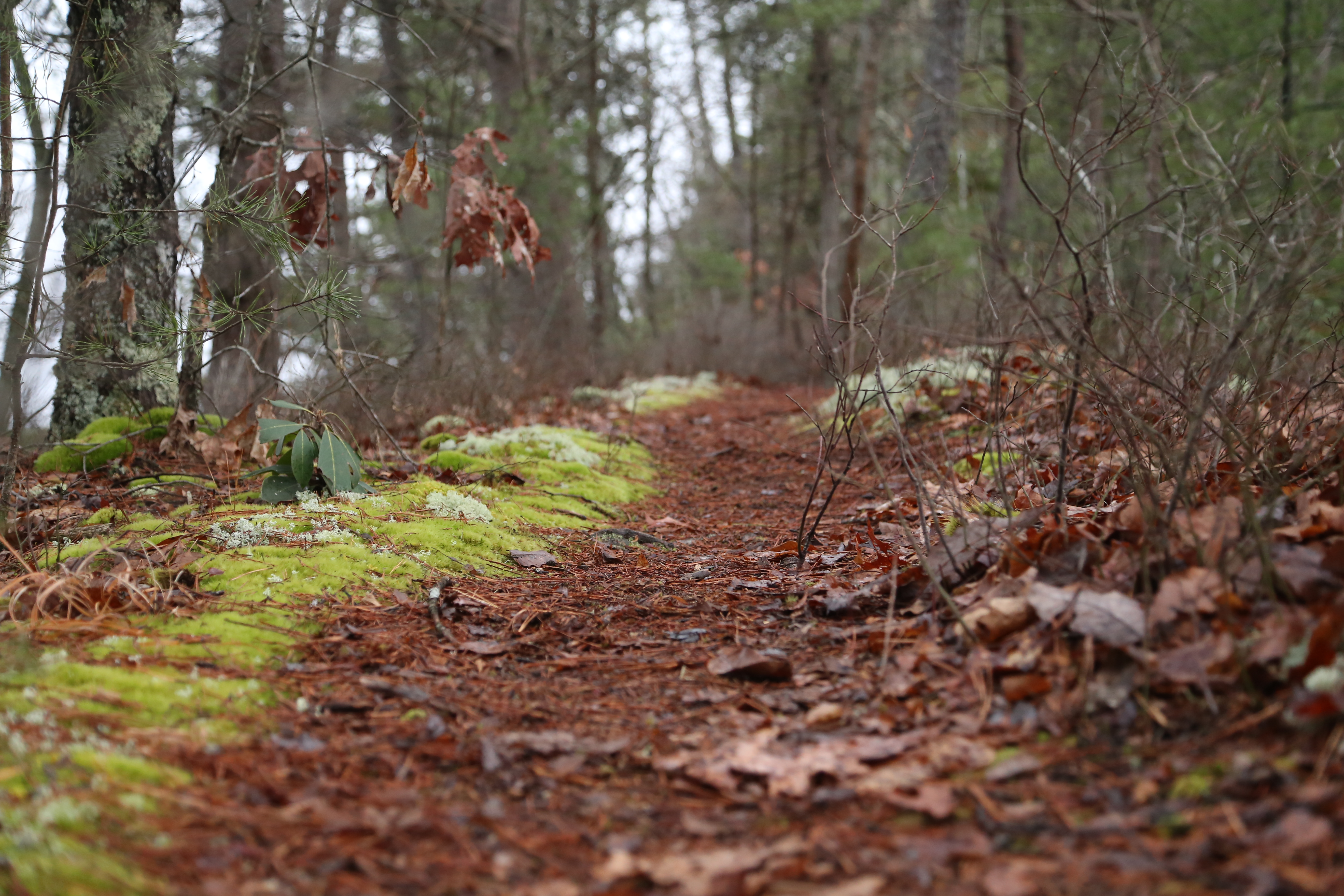
One of many creek crossings you’ll find in Red River Gorge this one on Chimney Top Creek on the Sheltowee Trace National Recreation Trail.

Turn back if you are in doubt or daylight is running out:  If you are in doubt or travel becomes too difficult or hazardous, it is always better to turn back and try another day.  Also, pay attention to the time as well as the distance you have traveled and the distance you still need to hike to reach your destination.  If it looks like you will lose daylight take the fastest and easiest route back to the trailhead.  Carrying a headlamp or flashlight is an essential precaution, but even with a light source night navigation is difficult in good conditions, and can be downright dangerous in many circumstances.

IMG_2678

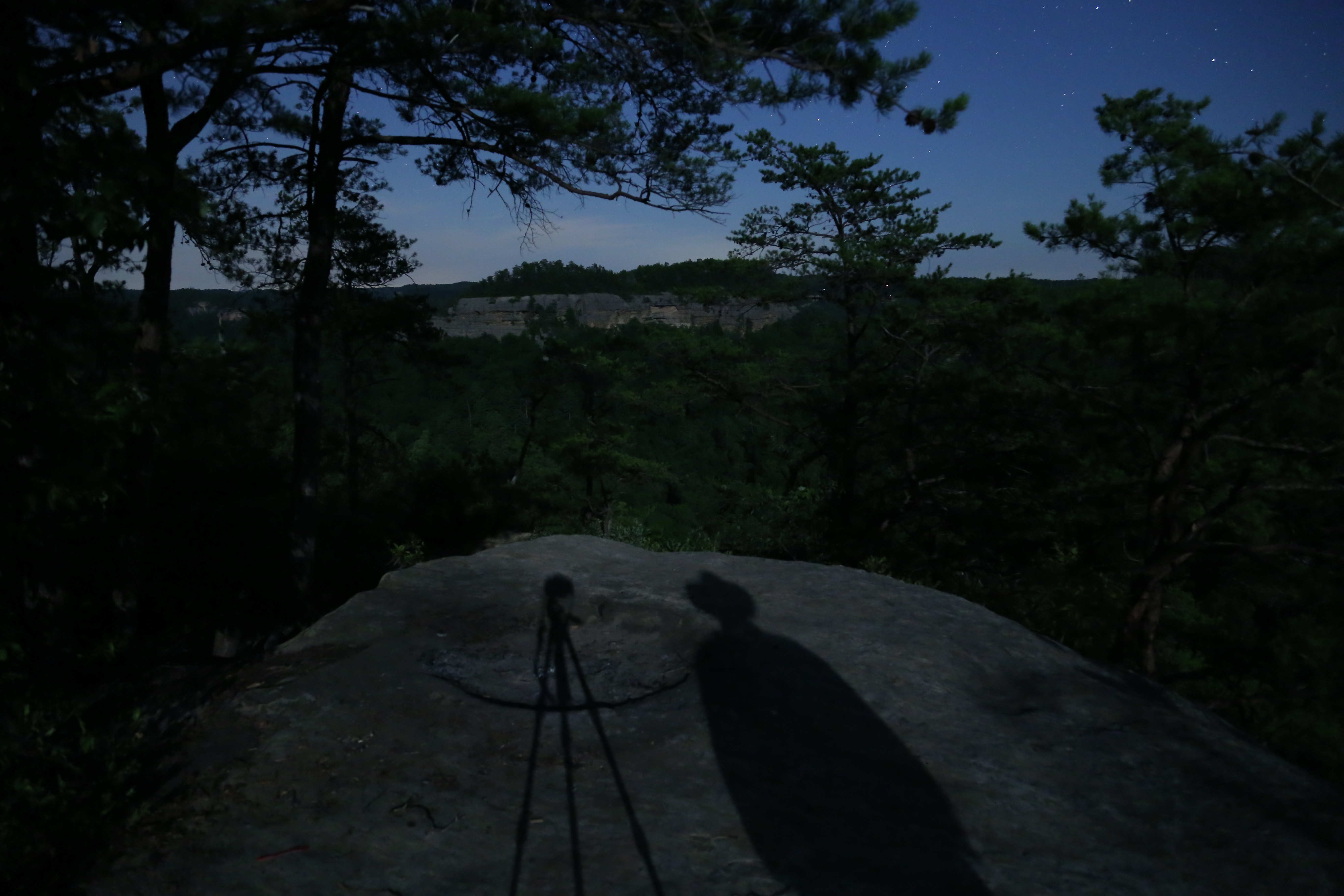
Night navigation is dangerous in areas with high cliffs.

Don’t panic and stay put if you really are lost:  If everything I have suggested here fails you and you believe you are lost, you need to stop, take a breath, and assess the situation.  Pull out your GPS, smartphone, or map and compass and perhaps after resting a few minutes to clear your head you will be able to figure out where you are.  If not, it is time to start thinking about shelter and other resources at your disposal, including ways to signal for help, but these are topics for another post.  If you really are lost and searchers need to be called in the worst thing you can do is wander aimlessly.  Stay put!  If you rush around in a panic you might end up getting injured and you will ultimately make it harder for a search team to find you.

IMG_3567

How prepared are you to spend the night if you get lost?

As for the couple we helped that day, their two biggest problems were inadequate planning and a serious lack of awareness on the trail.  By their own admission they did not know the area very well and did not do much homework or come prepared with a good map.  On the trail, after they veered off course, they passed through two trail junctions, a trailhead and parking area, and crossed a gravel road all of which were marked even on the basic overview map they were carrying.  Had they been paying more attention, any one of these features should have alerted them to their mistake and allowed them to take corrective action sooner.  With a more detailed map they also would have had a few more opportunities to right their wrong because they could have seen where their route was either paralleling or crossing a creek and they would have had a better understanding of the terrain they were traversing.  In the end they were fortunate they remained on the official trails (there are many unofficial trails in Red River Gorge) and that their detour led them to a trailhead where they were able to find assistance.

How to Not Get Lost Infographic

© Todd D. Nystrom and Todd the Hiker, 2017.

Advertisement

Hiking Devils Garden – Arches National Park

Arches National Park is a treasure trove of incredible landscapes and amazing geological features. According to the National Park Service website, “the park has over 2,000 natural stone arches, in addition to hundreds of soaring pinnacles, massive fins and giant balanced rocks.” The Devils Garden Trail includes all of this and offers the most challenging hike in the park, even for a seasoned hiker.

Arches is not considered a backcountry park, other than a few outlying areas accessible only in a high clearance vehicle, but this trail is your best chance of getting away from the crowds, even if it is only for short periods of time. This is the longest trail in Arches National Park. The NPS brochure for this hike places the total distance at 7.2 miles, including all of the side trails to the various arches and the primitive trail. It also includes some reasonably challenging rock scrambles, several steep climbs/descents, and narrow sections of trail with significant drop offs. If you reach a point where you do not feel comfortable traversing the terrain, I recommend you turn around and return via the primary trail. We encountered a number of hikers who did just this on the day we were there.

For your own safety and the protection of the sensitive desert landscape, stay on the trails! The sandstone fins are an amazing feature in the Devils Garden landscape, but they also present some interesting challenges to navigation. Pay close attention to the cairns that mark the way, especially on the primitive portion of the loop. Generally, the cairns are not too difficult to find, but make sure you locate the next cairn before you proceed, and backtrack to the last marker you observed if you are unable to find your way forward

At one point on the primitive trail it is possible you will encounter a pool of water that you will need to cross depending on the season (it was waist deep when we visited in mid-May). You will either need to drop into and wade through the water or scramble over the steep rock to one side. We chose the rock scramble which proved quite a challenge. It could easily have resulted in a dip in the pool we were attempting to avoid, but we successfully navigated the obstacle and remained dry in the process.

If you plan to do the full loop, I recommend following the primary trail out to Double O Arch and Dark Angel first and returning via the Primitive Trail. This allows you to visit most of the major landscape features first, just in case you encounter a section of the trail where you are not comfortable proceeding due to difficult conditions or your own skill level.

Don’t forget to pack plenty of water and enjoy the hike!

The first two arches you will encounter are Tunnel Arch and Pine Tree Arch both of which are accessible down a side trail that adds 0.5 miles to the total hike. Even though this is a short and easy trail, I suggest visiting these arches on the outbound trip as you may be inclined to bypass them if you are too tired on the return trip.

IMG_6432

Tunnel Arch

GOPR0080-0001

Pine Tree Arch

The next landmark you will encounter is Landscape Arch one of the best known arches in the park. Now at this point in the trail you will likely be thinking, “this is easy!” You may also be wondering if it is possible to escape the crowds, especially during busier times of the year. Not to worry, keep hiking because there is plenty of great scenery ahead, and the farther you go, the more likely you are to escape the crowd.

IMG_6438

Landscape Arch

Just past Landscape arch you will encounter the first obstacle that will cause some to turn back…we witnessed this when one member of a party decided they would rather return to the trailhead than continue on. At this point on the trail this is a perfectly safe thing to do, even for an individual person. The scramble up the relatively steep face of this sandstone fin is not really that difficult; however, if you have a fear of falling or a poor sense of balance it can be rather intimidating.

GOPR0081-0001

Climbing a steep fin…the first major challenge

Shortly after reaching the top of this fin you will encounter a side trail that leads to Partition Arch and Navajo Arch. This trail adds an additional 0.8 miles to the hike and like the other side trails is worth the effort.

IMG_6446

Partition Arch

IMG_6452

Navajo Arch

On the next section of trail, you traverse the top of a narrow fin with a serious drop off on both sides. For anyone with a fear of heights this will be a challenging section of trail, but the views are worth it! Descending off the fin also takes a bit of strategy so keep an eye out for markers that indicate the way down, as it is not the easiest route to find.

GOPR0085-0001

Traversing the top of a narrow fin

 A little further along you will encounter Double O Arch. The area under the arch was closed off when we visited due to a large chunk of rock breaking off and falling away from the arch a few weeks earlier during a period of significant rain…just part of the ever changing landscape.

IMG_6466

Double O Arch

The next landmark to visit is Dark Angel, a towering pinnacle, that requires an out and back side trail of 0.8 miles round trip, though I highly recommend not skipping this as the sweeping views at the end of the trail are well worth it!

IMG_6471

Dark Angel

IMG_6473

The amazing view looking back from the end of the Dark Angel trail

After backtracking on the Dark Angel trail, you have the option to return to the trailhead via the primary trail by which you came, or you can complete the loop on the Primitive Trail. If you found the main trail was intimidating and pushed your limits, then I do not recommend taking the Primitive Trail. If you are up to the challenge the effort is worth it, and make sure you don’t miss the only side trail out to Private Arch.

IMG_6480

Private Arch

Even though you won’t completely escape the crowds, especially on the easier portions of the trail, this hike is a must do for any serious hiker visiting Arches National Park. You can hike nearly all of the shorter trails in the park in the span of a single day, but make sure you carve out at least half a day (more if you are a photography buff) to do the entire Devil’s Garden Trail, including the Primitive Trail if you are up for the challenge!

IMG_6504

View from the back side of the Primitive Trail, looking up at the fin we crossed earlier in the hike…those are hikers up there!

© Todd D. Nystrom and Todd the Hiker, 2016.

Enter by the Narrow Gate

“Enter by the narrow gate. For the gate is wide and the way is easy that leads to destruction, and those who enter by it are many.  For the gate is narrow and the way is hard that leads to life, and those who find it are few.” ~Matthew 7:13-14 (ESV)

IMG_6480Private Arch, Arches National Park, Moab, Utah.

Private Arch is located on a side trail off the Devil’s Garden Primitive Loop in Arches National Park.  As the name Devil’s Garden suggests, this trail traverses a fairly harsh landscape and the primitive loop is an even more challenging trail that fewer visitors to Arches NP actually hike.  On the day we visited, private is exactly what we got.  Though the parking lot at the trailhead was bustling with visitors, and the easier sections of the Devil’s Garden trail were filled with a continuous stream of hikers, because we chose to take “the road less travelled,” we really had an opportunity to spend a little extra time enjoying the beauty and solitude of this hidden little corner of God’s creation.

Like the passage from Matthew’s gospel suggests, good things don’t always come easy.  Whether it is enjoying the beauty and solitude of a remote, less visited place in a busy national park, or the eternal life offered by following our Lord and Savior, Jesus Christ, the best destinations often require us to travel a more difficult path.

If you want to find your way to the less visited, scenic corners of our amazing national parks you either need to hire a guide who knows the trails or have a good map and the skills to read and follow it.

In our Christian walk we are equipped with the best map available, the Bible.  But more than that we have the Master guide himself, who has gone before us, paying the price for our sins, and who through His mercy and grace is ready to show us the way.

Christ is the narrow gate through which we enter, and though the path may at times be hard, the reward of this challenging journey is nothing less than eternal life with our Master in His glorious kingdom!

Yours in Christ,
Todd the Hiker

© Todd D. Nystrom and Todd the Hiker, 2015.

Air Travel Tips for Hikers & Backpackers

IMG_20150511_065141If you have flown anywhere in recent years you likely know the list of items you cannot bring along in your checked or carry-on luggage is rather extensive. For the average business or vacation traveler the challenge of packing is complicated enough; however, for those of us who like to spend our vacation time tromping through remote wilderness locations with a backpack full of gear, the challenge is even greater!

In this article I will focus on domestic air travel in the US, not to exclude anyone, but rather because the rules and regulations of international air travel include not only the safety and security concerns of our own US Transportation Security Administration (TSA) but also those of similar agencies in other nations. Keep in mind that customs and immigration laws unrelated to air travel safety will also apply, so even if an item can be transported in a carry-on bag, it may not be legal to bring that item through customs; for example many countries, including the US, ban the import of certain food items. My only recommendation, if you are planning an international trip, is to start your research early.

Do I Need to Check Baggage?

The short answer is yes! If you are flying and bringing your own gear it is safe to assume you will need at least one checked bag for your gear if you are day hiking, and likely one checked bag per person if you are backpacking. You need to research the checked baggage policies and fees when booking your flights as checked baggage fees can add up quickly, often $30 or more, per bag each way depending on the airline. Some carriers like Southwest Airlines still offer two checked bags per ticketed passenger at no extra charge. With their already low prices for airfare and the bonus of not having to pay extra for checked bags they are my personal favorite for our adventure travels whenever routes and schedules allow!

IMG_20150511_072601On the ground at Denver International Airport

Other Gear Transport Options

There are other options such as shipping your gear via a land based carrier, though, based on what I have paid to send Christmas gifts through various shippers in the recent years, the costs are significant, and restrictions still apply. In addition to the cost, there are many logistical and timing issues you will need to work through if you go this route. Another option I will mention is working with an outfitter who rents gear at, or will ship it to, your destination. I have done a cursory look around the internet and know there are a number of companies who do this, but cannot comment on the cost or availability of these services, which I expect vary significantly depending on where your adventures take you and what time of year you travel. Even if you use one of these options there are still items you will need to purchase at your destination, so planning and research are always a must.

Special Considerations

If you have special dietary needs or require special medical equipment, supplies, or medications you need to do your homework regarding air travel restrictions. If there are items you plan to purchase at your destination, I expect most cities large enough to have an airport will also have places to purchase whatever you need, but do not take this for granted, especially in more remote destinations. Spend some time on the internet researching options, and by all means, follow up with a phone call, especially for highly specialized or critical items.

Planning Ahead and Preparing to Pack

Start gathering your gear at least two weeks before your trip. Our dining room becomes a staging area for gear before any backpacking trip, but this is especially true for our trips that include air travel. Waiting until the last minute is a sure way to forget a critical piece of gear or leave something in a carry on bag that causes TSA agents and local police to take unwanted interest in you at the security check point! The later situation is certain to result in confiscation of the overlooked item, like a favorite pocket knife or multi-tool, or still worse, it could turn into a complete search of your person and baggage, a missed flight, and potentially a fine or even arrest, depending on what the item is.

IMG_5815Backpacking gear gathered in our dining room before a trip.

Check all the pockets in your backpacks and clothing to make sure there isn’t a spare lighter, fire starter, knife, or some other restricted item tucked away. And keep in mind that some outdoor clothing lines have hidden pockets and compartments for survival gear built into their clothing, so extra diligence is warranted with these types of items.

Packing Your Bags

The weight limit on checked bags is generally 50 pounds, with additional fees for oversize and overweight bags. As you pack your gear consider the fit as well as weight of each item. Once your bags are packed you should weigh them and make adjustments as needed.

IMG_5817Packed bags ready for weighing.

Having more than one checked bag gives you flexibility as you can shift items between bags to balance the weight and keep them all below the limit. If you check only a single bag you will need to closely watch the weight or just plan to pay the overweight baggage fee.

IMG_5820Hanging the bags on a luggage scale to ensure they are within the weight limits.

Guidelines for Specific Items

The table below is my attempt to cover the some of the most common items hikers and backpackers might carry. Though this is certainly not an exhaustive list, I have tried to make sure I included any gear I personally had questions or concerns about in the past. With a few items I could not find specific TSA guidelines. In those cases I have given my personal interpretation and practices which err on the conservative side, as I prefer the no hassle approach and would rather not risk losing valuable gear. As their website says on practically every page related to security guidelines, “The final decision rests with the TSA officer on whether an item is allowed through the checkpoint.”

If you have other items you are concerned about I suggest going to their “What Can I Bring?” page that allows you to search for guidelines on specific items yourself (their MyTSA App also has this feature). They also have an “AskTSA” service that allows you to send a photo of an item and ask questions through Facebook Messenger or Twitter (8 a.m. to 10 p.m. ET weekdays; 9 a.m. to 7 p.m. weekends/holidays). If you exhaust all these resources and still have questions, I suggest contacting the manufacturer of the item as they are likely to be aware of restrictions that apply to their products.

AirTravelRestrictions

At Your Destination

Another practice I recommend is taking time before your trip searching the internet for outfitters, grocery stores, and other vendors where you can purchase supplies once you arrive at your destination. This saves time, allows you to find the stores closest to your road travel route, and gives you an opportunity to call ahead to check hours and make sure any special items you need are available.

We tend to purchase most of our supplies in the cities where our flights take us. Cities with airports tend to be larger so the stores have a better selection and usually cheaper prices. That said, the stores we have patronized in and around the national parks have not had significantly higher prices. And, although the selection of items is usually limited, you should have no problem finding the basics of food, water, and fuel. Taking the time to do a little research in this area will save you time, frustration, and disappointment which is not what any of us want when we are tired from spending hours airports and sitting on a plane!

Final Advice

If you want to avoid hassles, delays, or the confiscation of an important piece of gear, I strongly suggest you err on the conservative side and leave questionable items at home or plan to purchase them at your destination. Consider every item you take, large or small. And, finally, make sure you check and double check your gear to ensure you don’t forget anything critical or leave a restricted item in a carry on or checked bag that will cause problems going through security screening at the airport.

Travel safe, hike safe, and by all means get out there and explore this vast, amazing, and beautiful world that God has blessed us with!

Happy Trails!

Todd the Hiker

© Todd D. Nystrom and Todd the Hiker, 2015-2020.

Relevant TSA Website Links:
What Can I Bring?: https://www.tsa.gov/travel/security-screening/whatcanibring/all
Liquids & Gels: https://www.tsa.gov/travel/security-screening/liquids-rule
MyTSA App: https://www.tsa.gov/mobile