
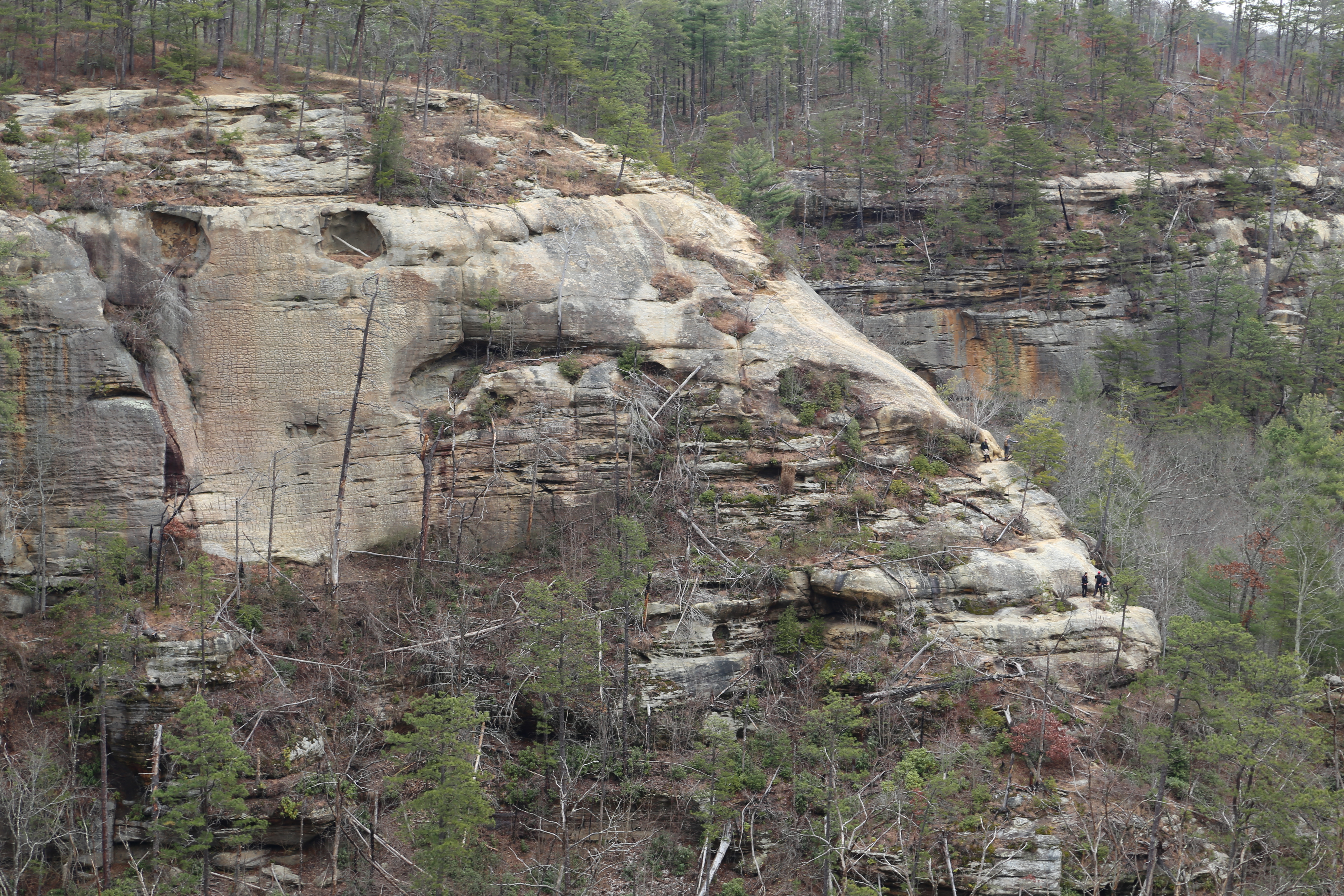
Featured Image: View of Indian Staircase from across the valley.
The Lord is my rock and my fortress and my deliverer, my God, my rock, in whom I take refuge, my shield, and the horn of my salvation, my stronghold. ~Psalm 18:2
Located about 45 minutes southeast of Lexington, Kentucky, and an easy two to two-and-a-half hour drive from Cincinnati, Ohio, Red River Gorge is a popular hiking and rock climbing destination in the western foothills of the Appalachian Mountains. Officially known as the Red River Gorge Geological Area, it is part of the much larger Daniel Boone National Forest.
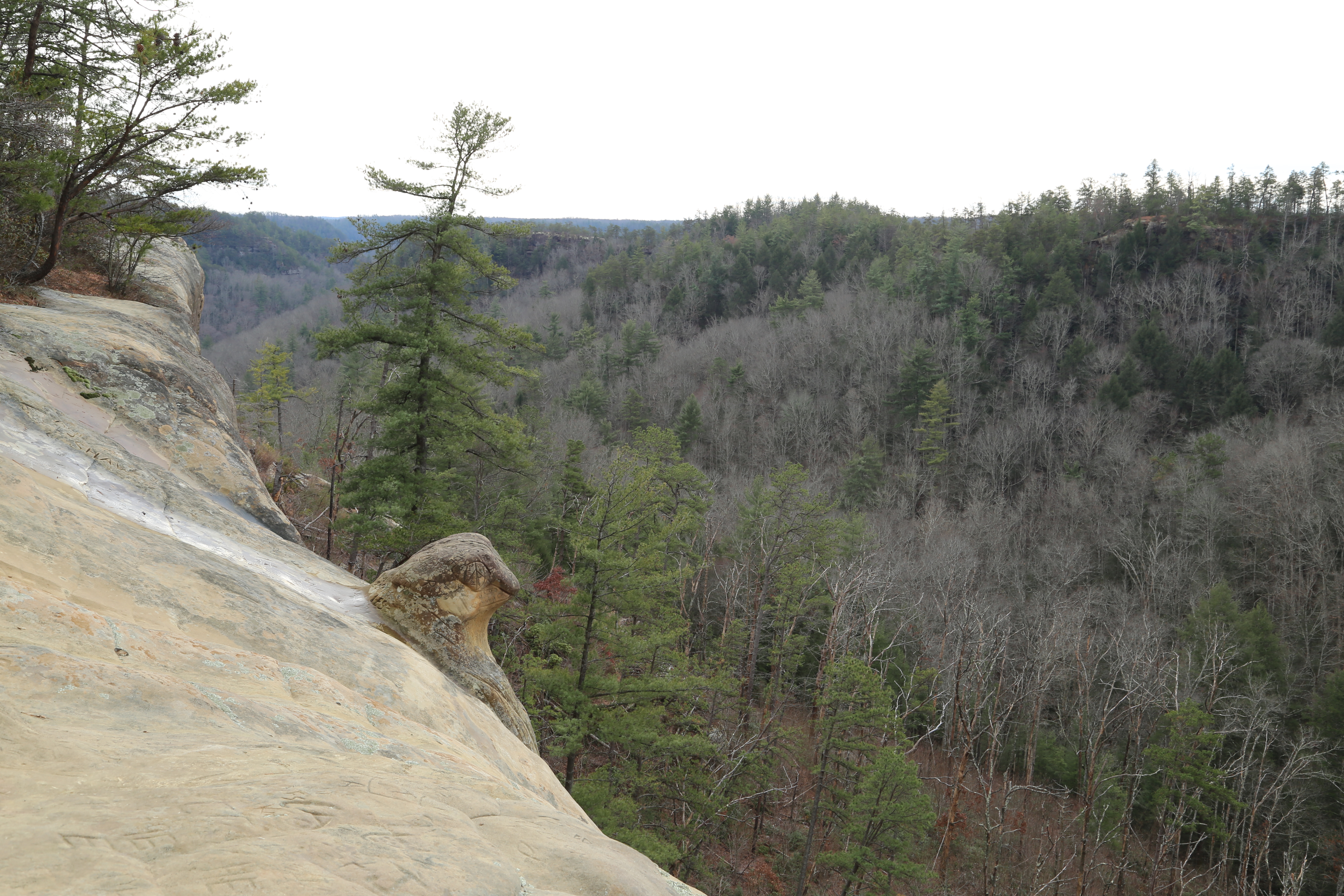
Red River Gorge boasts some of the most unique and rugged scenery in the region and is also home to over 100 natural rock arches from the small but still interesting, to the large and magnificent. Spectacular views, like the header photo of Indian Staircase taken from across the valley, are common throughout the gorge.
CAUTION: Sadly there are many who venture into amazing places like this dangerously unprepared for the challenges they will face and still others who are disrespectful of the environment and those around them. The route up Indian Staircase is extremely dangerous and I do not recommend hiking it unless you are an experienced hiker and are prepared for the strenuous, exposed climb to the top.
If you have any reservations at all about the climb up the exposed rock face of the staircase I suggest taking the alternate route to the top and even then you need to exercise great caution! The area above the staircase has an extended area of exposed cliff line that is also very dangerous. Avoid venturing too close to the cliff edges and do not become another statistic by being foolish! Respect the real dangers that are present, pack out anything that you pack in, and please avoid adding your artistic flair to the rocks and trees in this beautiful and sensitive area!
Hiking in Red River Gorge
If you are new to the area, are an inexperienced hiker, or are hiking with children I highly recommend sticking to the marked trails. There are numerous official trails in the gorge that boast equally as incredible views. My “Kentucky’s Red River Gorge” page provides more information on the gorge and also highlights several of our favorite hikes on the official trails ranging from easy to difficult. Even on the easier trails you will encounter high cliffs with no guard rails, so no matter how experienced you are or what trail, official or unofficial, you are on, exercise extreme caution. Steep drop-offs are often unseen until you are right on top of them; and if you are hiking with children keep them close by your side at all times!
Hiking Indian Staircase

Figure 1. Map of Indian Arch and vicinity.
Good topographic maps are a must if you are venturing off the official, marked trails in the gorge. I am a big fan of the maps offered by OutrageGIS, though the 2009 edition I use does not cover the trails around Indian Staircase. I do not know if the 2018 edition has been updated to include this area. For this hike I relied on the US Forest Service’s 2012 topographic map of the gorge (note: this is a 20 MB .pdf file and can be a slow download). This is a good map, but it does not show any of the unofficial trails, though I have sketched in the relevant trails on the modified map section shown in Figure 1. The best source of information for this hike was Jerrell Goodpaster’s book, “Hinterlands,” which describes over 100 unofficial trails in the gorge.
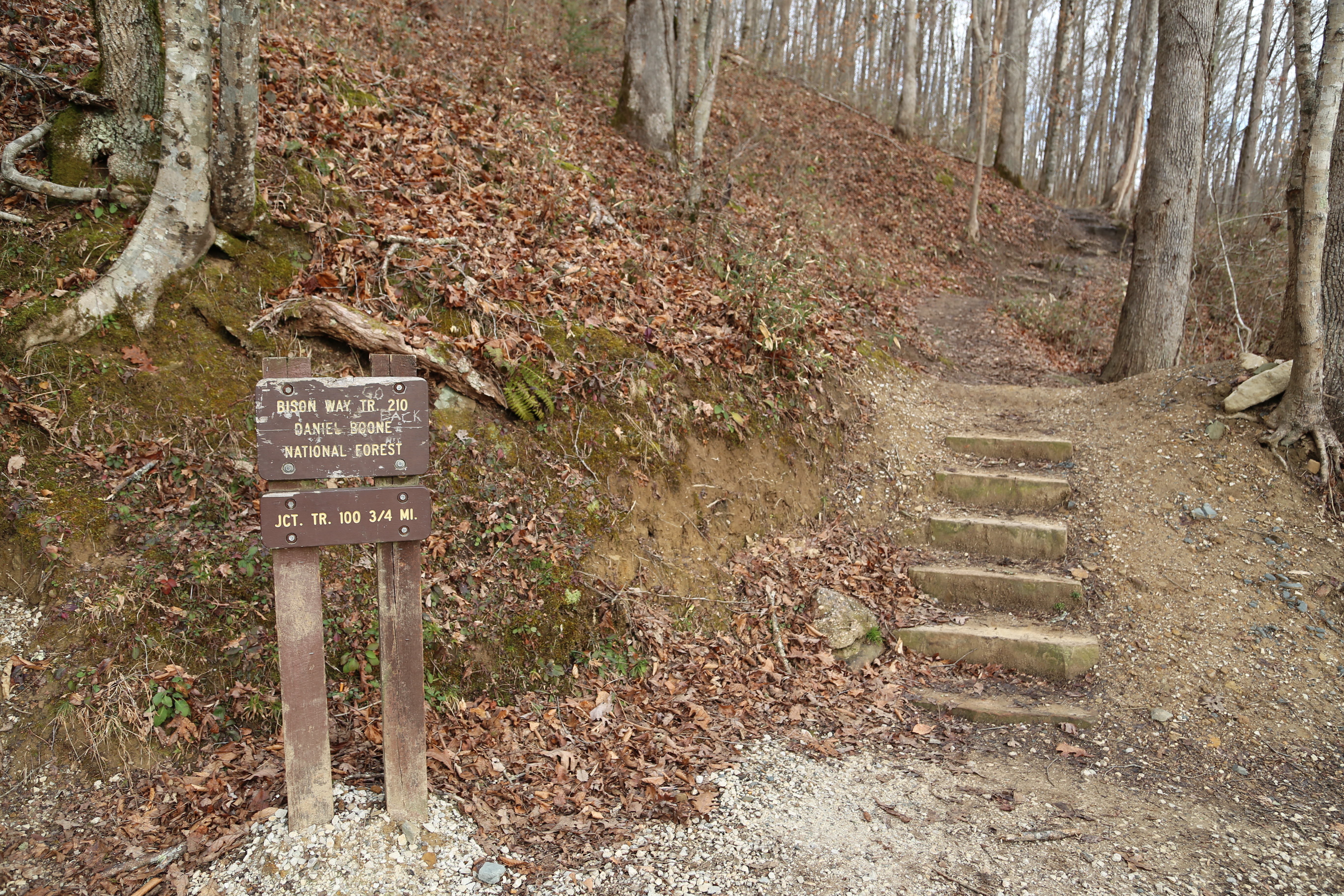
Bison Way Trailhead.
There are several ways to access Indian Staircase if you know the unofficial trails. We chose to park at the Bison Way trailhead along KY-715, near the Gladie Learning Center. We hiked the Bison Way Trail (#210) to the Sheltowee Trace (#100) and followed that west to the unofficial, unmarked approach trail to Indian Staircase. The approach trail is well traveled so it is not too difficult to find the cutoff or follow the trail itself.
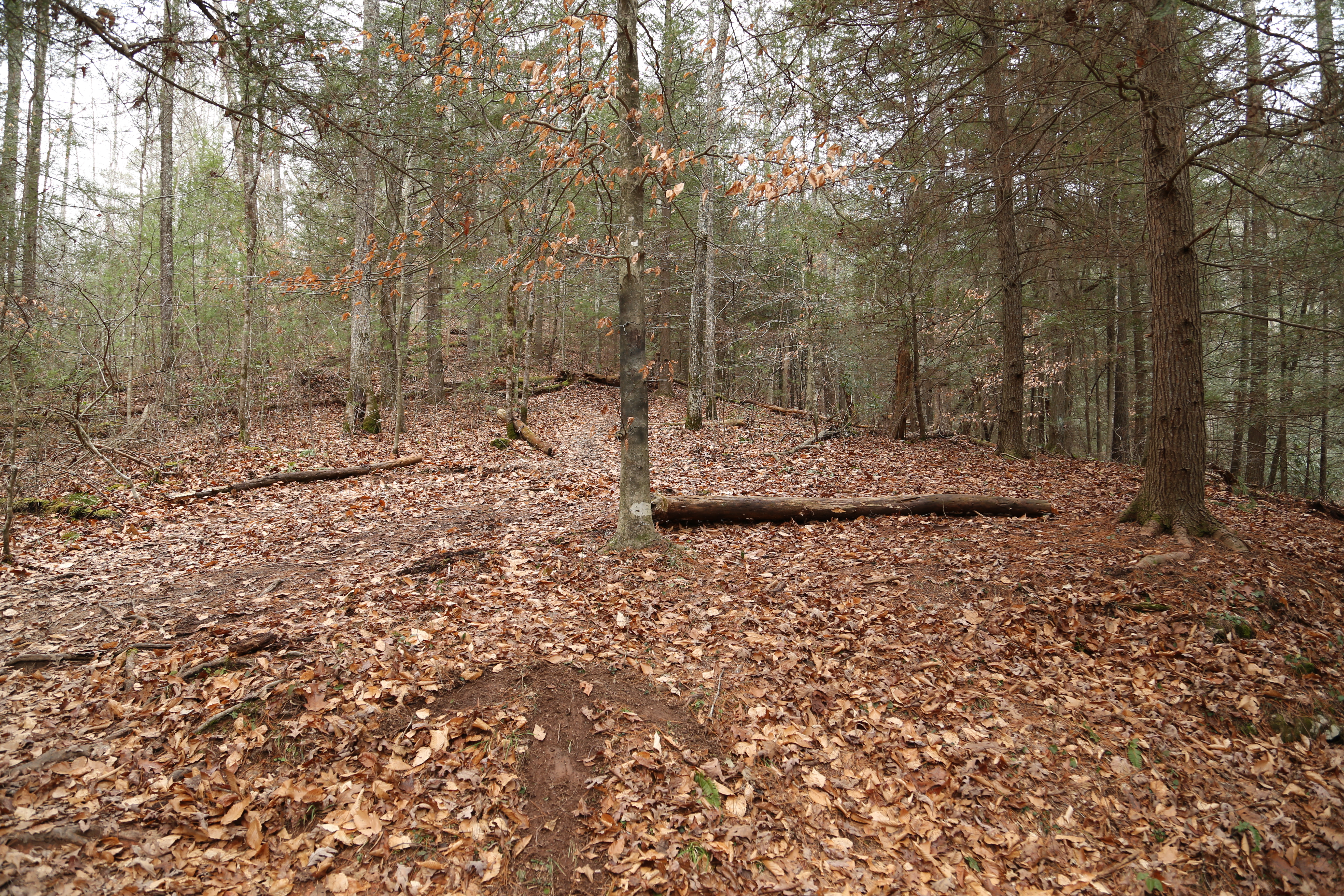
Start of the Indian Staircase Trail. On the day we were there someone had scratched out an arrow in the dirt indicating the way to Indian Staircase.

Two views of the rock scramble approaching Indian Staircase.
The approach trail climbs rapidly, heading northwest off the main trail. After a bit of uphill hiking you reach a rugged dry wash area that requires a scramble up the rocks. After completing this scramble there are several short sections that require a bit of searching in order to find the best way up to the next level. In my opinion the most intimidating part of climbing the staircase for the first time is that your sight range is often limited and you cannot see what lies ahead.

Carved footholds in the smooth sandstone face of Indian Staircase.
The final element of intimidation, though, is the fully exposed scramble up the smooth sandstone rock face with only the shallow carved footholds to assist you. This, of course, is the section of the trail that gives the rock formation its name. As legend has it these indentations were carved by the Adena people over a thousand years ago, though their true age and origin is likely lost to the annals of history. The slope is not as steep as it first seems, and the climb does not take ropes or climbing gear, but the completely exposed face adds a major intimidation factor. No matter how comfortable you might feel on exposed rock slopes, I would not recommend this climb if it is wet or icy!
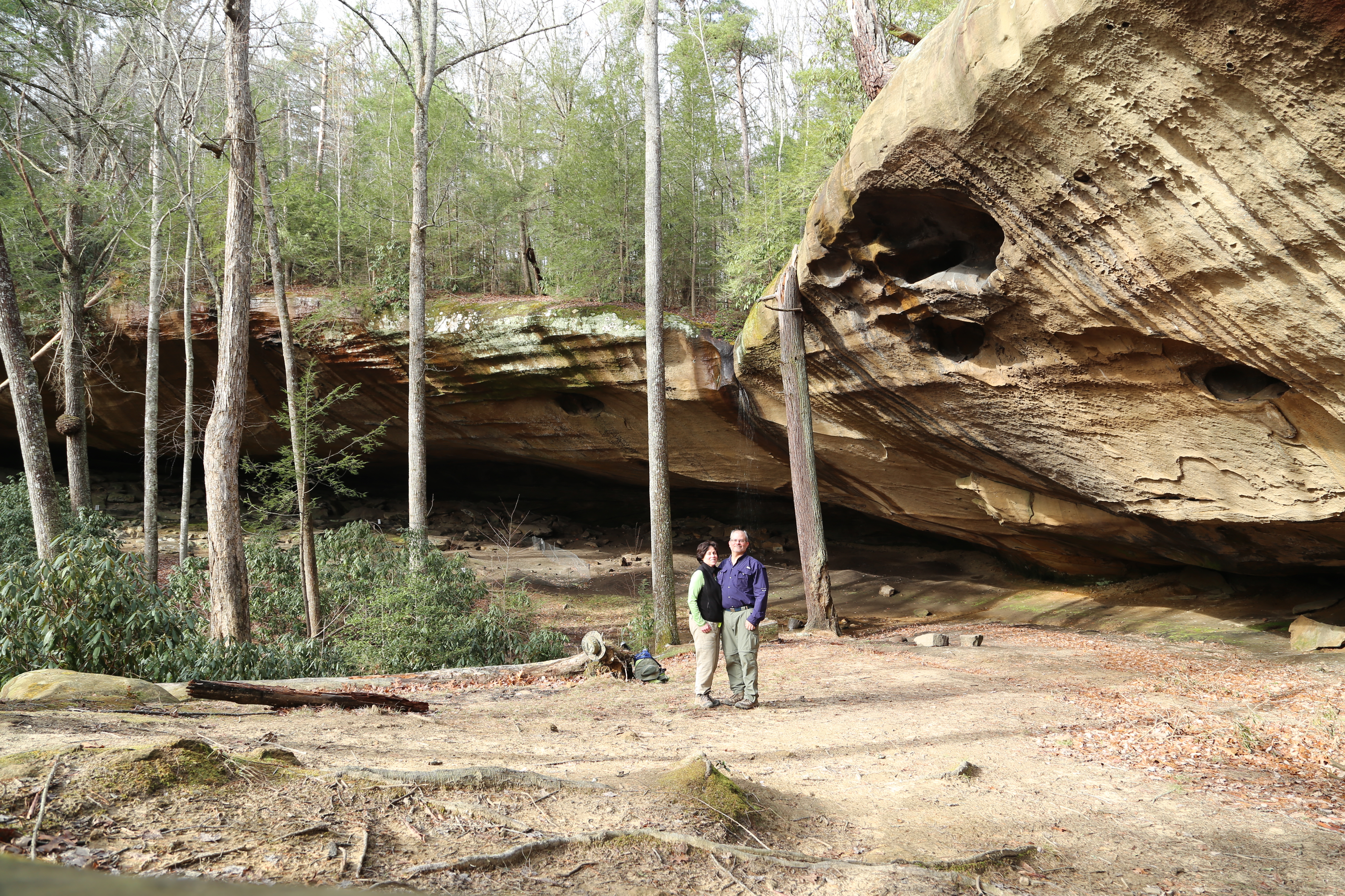
Council Chamber rock shelter.
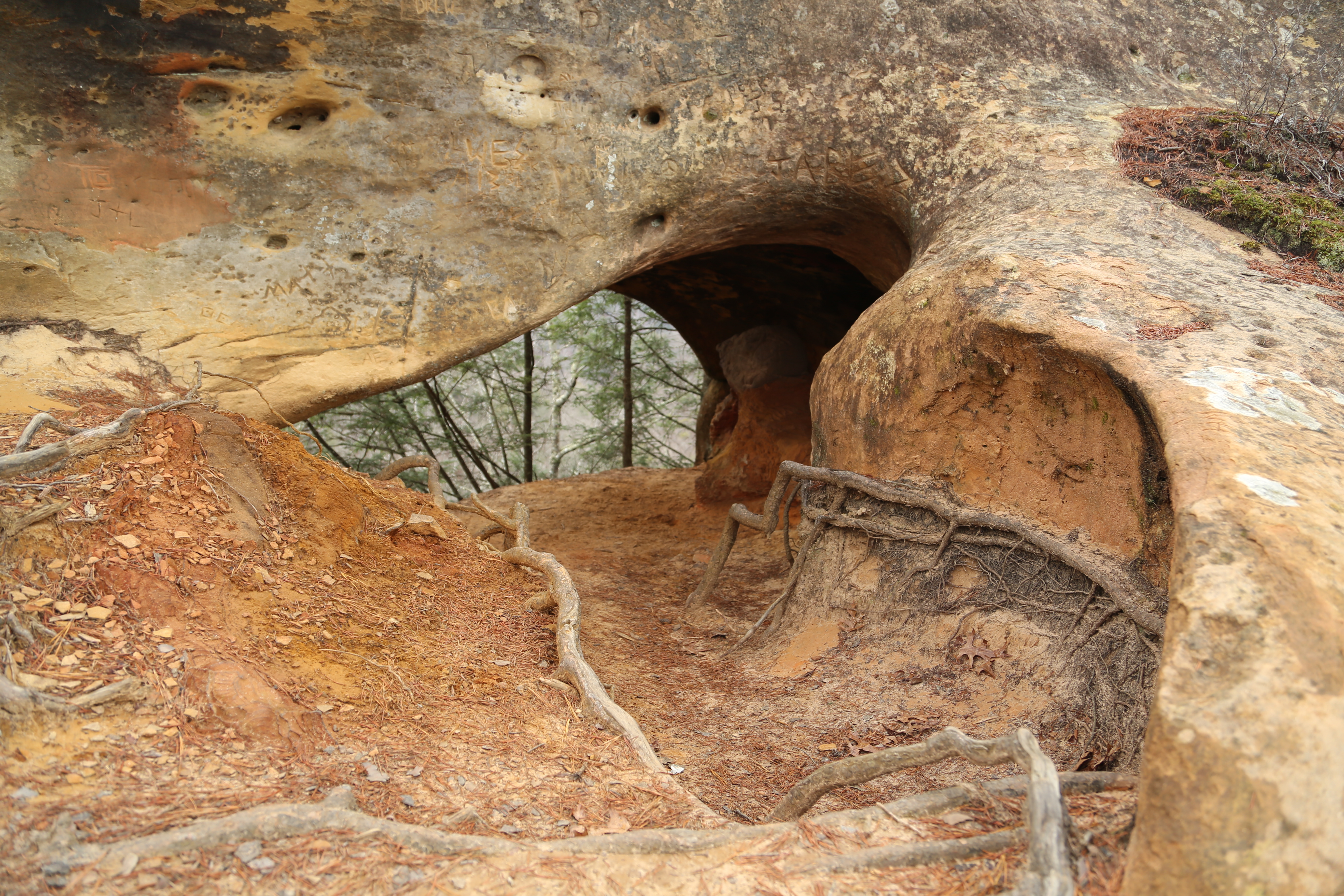
Frog’s Head Rock, sadly defaced by budding scribes over the years.
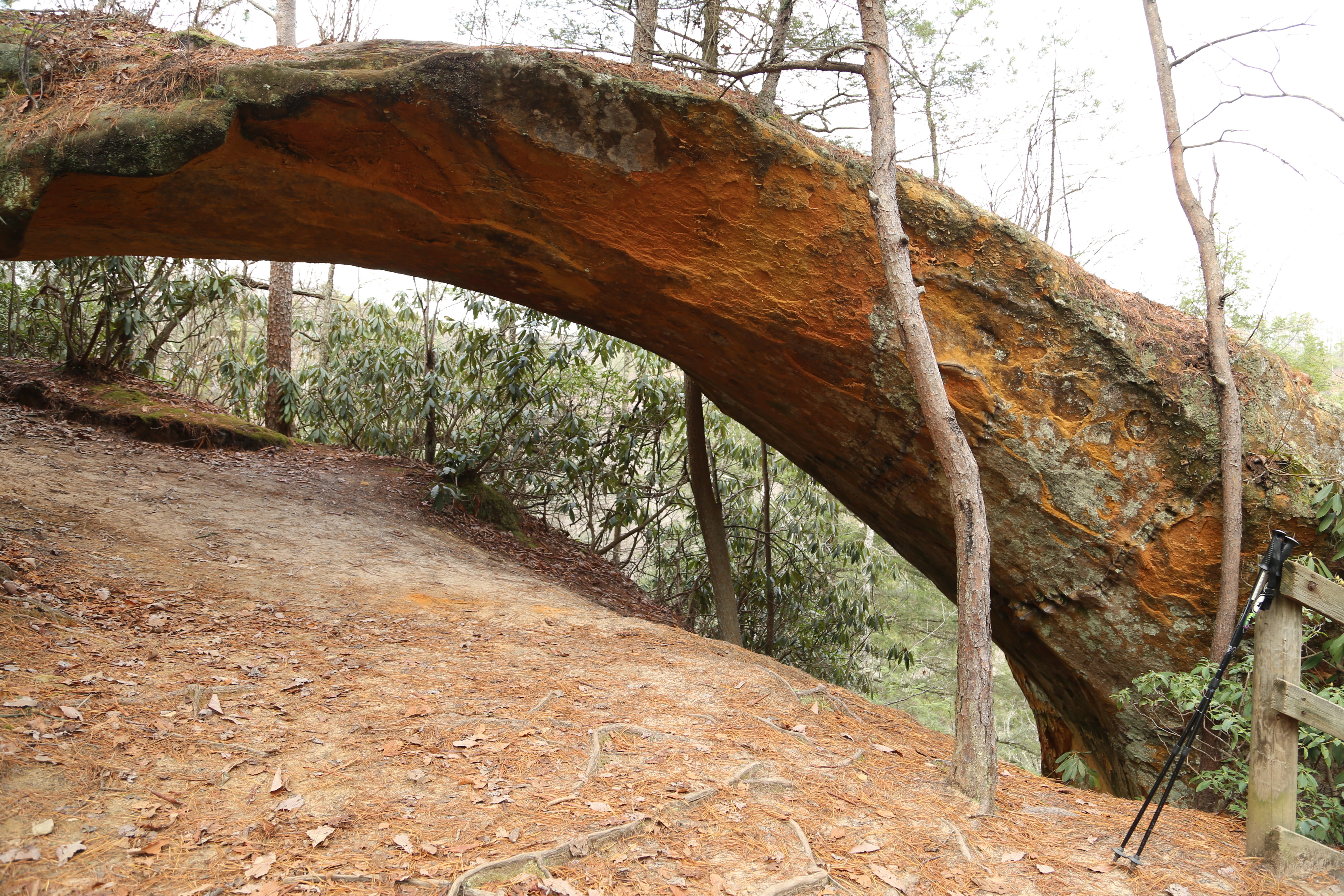
Even if you do not climb the staircase itself, it is still worth taking the long way around to get to the top by following the Sheltowee Trace and coming in from the west. There are a number of great features to explore in the area above the staircase including a spectacular, large rock shelter known as the Council Chamber, and an interesting little rock formation called the Frog’s Head. Regardless of which route you follow, I also recommend taking the unofficial side trail (one mile round trip) out to Adena Arch which boasts some spectacular views of its own.
Adena Arch.
Indian Arch, on the return hike along the Sheltowee Trace.
There are more areas we did not have time to explore on this hike, including the area on top and to the east of the staircase, as well as some interesting sounding features a friend told me about that are beyond the point we turned back near the Council Chamber rock shelter. I look forward to another hike on this route, not only to venture into these unexplored areas, but also to give the staircase a better assessment without the first-time intimidation factor, and to take more photographs documenting the climb. For now, I hope this gives you enough information to find your way on this adventurous hike and that my photographs will inspire you to make the trip to explore this spectacular little corner of Red River Gorge!
© Todd D. Nystrom and Todd the Hiker, 2015.

Just came across this post and I use to hike there a lot when I was younger. Hope to back there in the future.
We try to get down there as often as possible, still have a few miles of trails we’ve yet to explore.
If you continue thru the Council Chamber rock shelter, a trail follows along the side of the cliff, below the ridge line, that eventually hooks back up with the trail at the top of ridge (before you get back to the Sheltowee trace). Really nice views along cliff looking back at the staircase.
Thanks, Barry. I have been back since I originally wrote this and have hiked out past the Council Chamber. One of these days I need to update my page to include this part of the trail, as well.