
My name is Todd Nystrom (pronounced NICE-strum) a.k.a. “Todd the Hiker.” First and foremost I am a Christian, a servant of our Lord and Savior, Jesus Christ. I live with my wife Leah in suburban Cincinnati, Ohio. We have two grown and married children, our daughter and her husband who have blessed us with five grandchildren, and our son and his wife who have blessed us with two grandchildren. In our free time we can often be found hiking, backpacking, and simply enjoying the incredible beauty of God’s magnificent creation.

Grandpa (Pap) and grandson hiking at Germantown MetroPark, Germantown, Ohio (photo by Leah Nystrom).
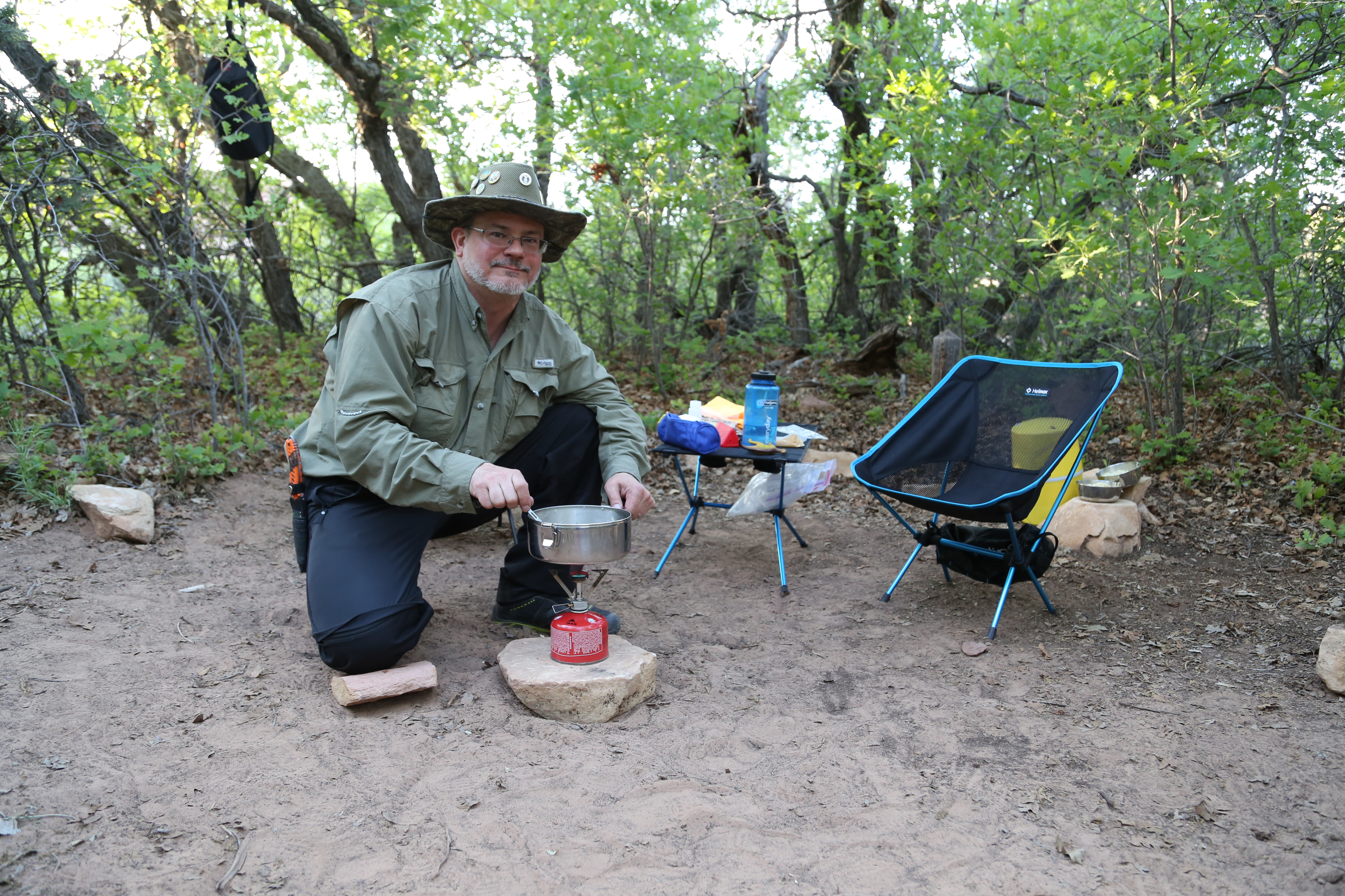
I grew up in a Christian home knowing the blessing of having a father and mother who faithfully served the Lord. Through the ups and downs of life, many prayers, and with the help of the Holy Spirit, I continue to grow in my Christian walk, and serve as an elder at our church, North Cincinnati Community Church (PCA), in Mason, Ohio. I am also an avid outdoorsman who loves hiking, backpacking, camping, and photography. I gained my appreciation for the outdoors at an early age, learning to hunt and fish with my father, and enjoying many summertime camping trips with my family in Michigan’s rugged and remote Upper Peninsula.
 A much younger Todd the Hiker with a 36 inch, 13 pound northern pike caught on Greenwood Reservoir in Michigan’s Upper Peninsula.
It was later in life that I began to consider the possibilities of connecting my love of Christ with my love of hiking and the outdoors; and, in 2009, inspired by our head pastor’s sermon on Mark 6:31, titled “Finding Time in the Margin,” I decided to start a hiking fellowship ministry in our church. Now, several times each year, I plan and lead group day hikes, camping trips, and wilderness retreats to the many great outdoor locations within a few hour’s drive of Cincinnati. Also, since 2011, I have been blessed to lead an outdoor adventure camp teaching children wilderness safety, basic first aid, and map & compass skills. This camp is part of our church’s larger summer youth ministry program, called MVP Camp. I have also taught map & compass skills and basic photography skills to one of our local American Heritage Girl troops. And, in addition to my outdoor related ministries, I have taught adult Sunday school classes and worked alongside my wife teaching our church’s 2, 3, & 4 year old Sunday school classes. I am certified in basic first aid/CPR/AED, wilderness first aid, and basic wilderness survival skills, all skills which I have fortunately never needed to draw upon (except for the occasional adhesive bandage) in any of our individual or group outdoor adventures.
I am not a professional pastor with a formal seminary education, but have taken some basic theological training required to serve as a deacon or elder in our church. More than anything, I have a passion to serve Christ through outdoor ministry that stems from a lifetime of personal experience in the outdoors and a love for reading and studying the Bible and all things theological! I have a bachelor’s degree in electrical engineering from Michigan State University and a master’s degree in research & development management from the Air Force Institute of Technology. In my professional career I served 10 years as an officer in the USAF and 20 years working as an engineer, project manager, and software program manager at a major, Fortune 500 company in the Cincinnati area. At this point I am working for a small company in the area and am considering what I want to do to bridge the gap until retirement.
In early 2015 I was selected as a brand ambassador by two well known outdoor brands, Ultimate Survival Technologies and Rocky Boots, through their Rocky S2V product line. Unfortunately both companies have discontinued these particular ambassador programs; but, during the time I had the privilege to be a part these programs I got to test, review, and promote gear, which was a huge honor. Most of all, though, it helped me reach a much larger audience and gave me opportunities to connect with many new people who share my love of the outdoors.
Through this blog I hope to share my love of Christ and his creation, as well as my thoughts on outdoor ministry, amazing places to visit, outdoor safety, skills, and gear. By reading this blog I hope you are inspired to get outdoors more and safely enjoy the amazing beauty of God’s great creation, but most importantly that you would be motivated to serve our Lord and Savior in your own unique way. Thank you for visiting my site!
Now, get outdoors, stay safe, and happy trails!!
Yours in Christ,
Todd D. Nystrom a.k.a. “Todd the Hiker”Follow @Todd_the_Hiker
© Todd D. Nystrom and Todd the Hiker, 2013-2022.
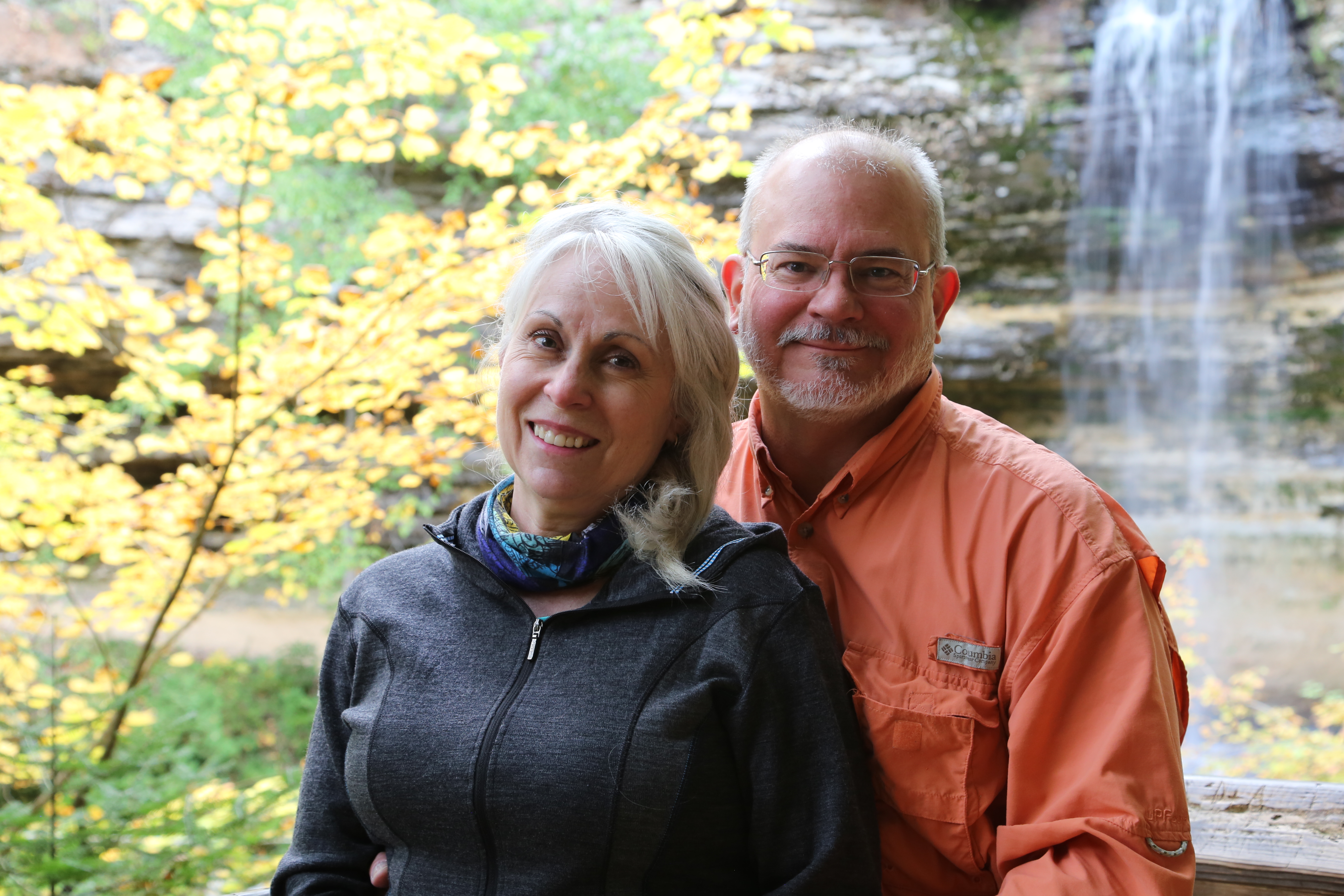
This is a photo of Leah and me enjoying the beauty and magnificence of God’s amazing creation at Munising Falls in Pictured Rocks National Lakeshore on one of many trips the beautiful Upper Peninsula of Michigan. Our God is truly an awesome God!!!!

Hey Todd! Do you have any suggestions on a good trail to hike/camp with my 5 year old son i the Red River Gorge? Thinking about 3 miles in and out at the most.
Thanks in advance for any suggestions!
Jason
Jason,
Assuming you are OK hiking/camping with cliffs nearby, I will suggest hiking out to and camping on the unofficial “Veranda” trail. There are two nice, established campsites on this unofficial trail, one that is at least 50 yards from the nearest cliff and the other that is 10-20 yards from the nearest cliff. Also, the view from the end of the “Veranda” trail is incredible!
You can park at any of three different trailheads, Pinch-Em-Tight, Gray’s Arch, or Archaic which is helpful if you go on a busy weekend. You also have two options for the hike to get there, the longer, scenic route that takes you past Gray’s Arch (appx. 3 miles with a substantial descent and ascent), or the shorter, easier route following Pinch-Em-Tight trail (#223) to Rush Ridge (#227) trail directly to Rough Trail (appx. 1.5 miles with no substantial ascent or descent). This also give you the ability to make a loop if you are so inclined.
This Google Maps link shows all the trails I mention, including the unofficial “Veranda” trail out at the end of Rush Ridge: https://www.google.com/maps/d/edit?mid=11fz-2CAjd3fZdQEjJ2_-DC2zx0xu2ajH&usp=sharing
A few additional things to be aware of: 1) As I have already said, there are exposed cliff areas on these trails, but that is something you will find just about anywhere in RRG; 2) Bring all the water you will need as there are no potable water sources at the trailheads nor water sources (filtering required) anywhere along Rush Ridge or the “Veranda” trail. The only place with water is between Gray’s Arch and Rush Ridge on Rough Trail; 3) With the crowds that have been down in RRG this year, and nice fall weather, if you can get down there Friday afternoon or very early (before 9:00 AM) on Saturday morning you will have a much better chance of finding parking.
Let me know if you are looking for something different than this, and I will see what else I can recommend.
I hope you and your son thoroughly enjoy RRG!!
Todd
I’m from Nebraska. And we’re bringing a Boy Scout Venture Crew to hike and back country camp. We are planning to do the Auxier Ridge (#204), Auxier Branch (#203), Double Arch (#201) Loop in July. Are there any maps that show water resources in July? We will have equipment to treat water but are worried about finding water sources.
Rich
Rich,
That is definitely one of the most scenic routes in RRG and well worth the trip. You are right about concerns for water sources, though, as the only source for water on that route is where the Auxier Branch trail (#203) parallels and crosses Auxier Branch. It is flowing and reliable even in pretty dry seasons, so you can count on that spot to collect and treat water. Except for that stretch of trail everything else is either up on a ridge, or descending/ascending from/to the ridge tops with no water sources.
Also be aware that there are no water supplies at the trailheads, so you’ll need to bring your own water for the start of your trip, as well.
Enjoy your trip to the Gorge!!!
Happy trails,
Todd
Thank you!
<
div dir=”ltr”>
<
blockquote type=”cite”>
Hi Todd. Hopefully we can meet sometime, it seems we have a lot in common. I grew up in the Upper Peninsula of Michigan and now live in Mason, Oh. I too have served as an Elder and love to point out to others the attributes of God that can be seen through His creation.
I am planning my first trip to Red River Gorge—a winter time primitive camping trip. What area of the gorge would you suggest? Any “must see” areas of the gorge?
Bob,
It sounds like we definitely have some common ground!
There are so many great spots, but my recommendation for a first time visit to RRG is definitely the Auxier Ridge/Double Arch area. The views are amazing!
I’d be happy to connect for lunch sometime to swap stories and I could give you a few more tailored suggestions on the gorge, as well.
Todd
Love your notes /blog about the trail & off trail. I am looking for the easiest way to get from the Auxier Ridge trail system down to where the Rough Trail begins on 77 near Martins Fork. Is there an unmarked trail that would connect the two…or do you know of a bush whack way to connect them? Curious.
Thank you, David!
There is an unofficial trail off of Tunnel Ridge Road near the Auxier Ridge Trailhead.
The start of this unofficial trail is pretty easy to find, exiting to the east on the curve of Tunnel Ridge Road. It is pretty well traveled for about the first 1/4 mile, but after that there is a 1/4 mile (or maybe a little more) that will be tough going with some route finding difficulty and bushwhacking at points. As long as you remain on top of the ridge travelling east you will be OK and should eventually pick up the trail again. After the difficult section the trail is once again well traveled and easy to follow.
At one point the trail will connect with another very well traveled trail running roughly north/south. To the left this trail leads to a spectacular view point overlooking Raven Rock and to the right there is supposedly a route down to the Martin’s Fork Trailhead. I say supposedly because while I have hiked the trail from Auxier Ridge to the Raven Rock overlook, I have never attempted to get up or down this ridge from the Martin’s Fork Trailhead. From what I understand there is some pretty significant rock climbing and or scrambles involved in the ascent and descent, but I cannot comment on just how difficult or technical this may be.
Here is a link to a Google Map where I have shown a GPS route from a hike we did there last fall: https://drive.google.com/open?id=1Mce56_B4Cr3011l9CIM7trAgdl4&usp=sharing
Hopefully this proves helpful! And, if you do find the route up/down from the Martin’s Fork Trailhead I would love to hear your thoughts on the difficulty of that route.
Best Regards,
Todd the Hiker
Todd, SundayI hiked the Rough Trail from SwiftCamp Crek/ Rough trail head all way through to Martins Fork, then with your help hiked up the steep deer tail behind the sign in the Martins Fork parking lot, there were two very steep rock outcropping that I had to carefully navigate (manageable scramble climbs though ). Once on the ridgetop there was a beautiful campsite & a trail that obviously headed northeast towards Ravens Rock area & a much more over grown trail heading westward towards tunnel ridge Rd (where I had my wife help me drop a vehicle earlier in the day). Approx 13 miles total. The Ridge too trail is EXTREMELY OVEGROWN this time of year. ( I have heard other youtubers refer to this Ridge trail as ‘Daniel Boone Byway’. ..While it was cool to be able to connect the two trail systems…I don’t think I’d attempt again until late fall/winter when brush dies down a bit…lol. Lots a chiggers/briars & probably snakes as well this time of the year (although I didn’t encounter any on that part of the trail) …happy trails.
David,
Thanks for the feedback, it is nice to have some characterization of the climb and connection up from the Martin’s Fork trailhead. We hiked the overgrown section you mention on October 8th last year (early fall of 2016) as an out-and-back from the Auxier Ridge trailhead. It was still pretty thick at that time of year, and we definitely had to do some bushwhacking, though I suspect it was not as bad as it is this time of year. That said, we hiked it on an absolutely beautiful fall day when the official trails were packed with people and only saw two other hikers after we were on the unofficial trail hiking east off of Tunnel Ridge Road. I definitely prefer bushwhacking over crowds any day, though. Happy trails to you, as well!
Todd
Hi Todd, I really enjoyed scrolling through your posts, and reading your witness of the Lord. I too am a Christian nature lover and aspiring to glorify God through creating and selling light-filled impressionistic landscape paintings. Could you email me, as I have a question about using 2-3 of your photos as inspiration for oil paintings? Thank you!.
Todd, thank you for your informative site and and the glory you give to God for His creation! We have enjoyed camping in RRG over the past five years with our young and growing family. We’ve usually gone down over long weekends and like to try to attend church on Sunday, but haven’t been all that encouraged with what we’ve found. We attend a Reformed Baptist church in Ohio, and PCA or OPC would be great too, but I haven’t found anything reformed leaning near RRG. I’m wondering if you have any suggestions for churches near the Red River Gorge area?
Paul,
You are quite welcome! I am glad you find my site informative and giving glory to God for his creation is what got me started out here in the blogosphere.
As for reformed leaning churches near Red River Gorge, the choices are very limited. There is at least one SBC church in Stanton (Emmanuel Baptist Church (SBC) – 745 W College Ave, Stanton, KY 40380) which based on their website (https://ebcstanton.org/welcome/) looks quite solid, but I have no personal experience with them. There may be other options in Ervine or Mt. Sterling, but they are much further than Stanton.
The three closest PCA churces are Trinity Church PCA in Richmond, KY and Tates Creek Presbyterian and Christ Covenant Presbyterian in Lexington, KY but again farther than you are probably looking for. A search of the OPC church directory shows only one church in Kentucky that is nowhere near RRG.
Hopefully this is helpful!
In Him,
“Todd the Hiker”
Todd,
Thanks for the details. We have attended EBC several times in the past. It was the best we could find online as well.
Keep up the good work on the website and God bless!
–Paul
Thanks and God bless to you and yours, as well!
Love hearing about other outspoken Christians who share similar passions. Stumbled across your site while researching trip ideas for RRG coming up in a couple of weeks. Thanks for your write ups.
I’m looking forward to introducing a fellow sailor to backpacking.
Thanks for stopping by, it is always great to connect with other Christians who enjoy God’s amazing creation! I hope you have a great trip and that your friend enjoys backpacking and RRG!
Hello Todd,
I came across your blog by googling hiking Caesar’s Creek lake. I love to hike and Caesars Creek is my primary hiking spot since it’s so close to home (Lebanon). I enjoyed reading your blog and we have a little in common; Christian, hiking, and USAF (retired MSgt). I love to be out on the trail and having that peaceful time with God (and occasionally human companions).
God bless you brother.
Kevin Nicholas
Perhaps we’ll run into each other up at Caesar Creek sometime, my wife and I hike there often, also because of the proximity to home. We were just up there last week with two of our grandkids for a short hike.
God bless you, as well, brother!
Hi – Could you email me about the possible use of one of your Caesar’s Creek photos in the Waynesville Band Community Calendar? Thanks! Amy
Certainly Amy. Email on the way shortly.
Todd, my name is Ashley Gillihan and I (with two other friends) own Hike With God, Inc. (check us out at HikewithGod.com). We love hiking and decided to start a hiking apparel business that was designed to incite people to connect hiking with God. Would love to chat with you about ways to connect as we share similar interests in the outdoor and God. My email address is hikewithgod.com
Ashley, thanks for reaching connecting. I will reach out to you via email soon. Todd
How about that. My wife and I attend a PCA church as well.
Smaller but growing denomination especially up here in Ohio.
Your story is inspiring! Thanks, Lilly & Ray Harold
Thank you!
Todd, I publish Shout! Outdoor Lifestyle Magazine. I’m interested in your contributing.
Brad, Thank you for reaching out! I am honored and very interested.
Stupendous site! Todd, I am a professional photographer and plan on shooting the Milky Way from Sky Bridge this evening (1-2 AM). Besides Sky Bridge, are there any other trails or location(s) that have a very good view and face south? Appreciate your time and any feedback.
Thanks Jeff! I assume major off trail hikes would be out as those would be impossible without good maps and would also be difficult to describe here in a comment. That said, one good south facing, short, and easy trail is Chimney Rock which has a great open south facing view.
Good Morning Todd. Just wanted to say I linked your map of the Indian Staircase route in my page on the Red River Gorge’s Cloud Splitter in summitpost.org. It is by far the best I have come across. Thanks!
Thanks Stu!
Thanks for the blog and info, Todd. I’m taking my family down to the Gorge in mid April to backpack. This has been helpful. I was curious about water. Do you pack it in or filter it from streams? I have a Katadyn Basecamp gravity filter. Will that work, or will I need a pump filter? Any advice would be great. Thanks!
Nate, we have done both, pack water in and resupply from the streams. In April you will have no problem with dry, seasonal streams. A gravity filter will work just fine as all the streams should be running very full in mid April, especially after all the snow they’ve had down there.
The primary thing to consider in the pack vs. filter decision is whether your route will take you down in the valleys where the streams are, or keep you completely up on the ridges. When we’ve camped at some of our favorite spots up on the ridges, it has been a pretty good hike (1-2 miles round trip) to fetch water.
April is a great time down there with all the spring blossoms, we just might see you there. Enjoy!!
Awesome! Thanks, Todd.
You’re welcome, Nate.
Hiking in God’s creation is as close as we can get to God on earth. I’m not an avid hiker, but I enjoy a hike now and then. In between which I enjoy creation photography, mine or others.
Seeing the amazing beauty of God’s creation here in this fallen world leaves me with great anticipation for what it will be like when all is made new upon Christ’s return!
I just want to say I so enjoy your blog and appreciate all the support you have shown me this year! That is why I nominated you for the Blog of the Year 2013 Award. You can view your nomination at http://aheartofadventure.com/2013/12/30/blog-of-the-year-2013-award/ Have a wonderful and adventurous new year!