If you venture outdoors, especially in more rugged and remote locations, you really need to take time to learn how to read a topographic map and use a compass to navigate, then make sure you carry them both when you go into the backcountry! For anyone old enough to remember the days of ordering paper copies of the United States Geological Survey (USGS) 7.5 minute (7.5’) quadrangle topographic maps, quads for short, and waiting for these prized treasures to arrive via snail mail, or hoping you could find an outfitter nearby that had your needed maps in stock, the digital world of the 21st century is an amazing place!
There is a plethora of online sources for maps, guides, and reviews of hiking and backpacking destinations both popular and obscure. Not only can you access this information in mere minutes from the comfort of home, you can also download high quality digital versions of many documents legally and for FREE! We are not talking about bootleg copies created on a home scanner by some computer savvy geek with cheese-puff-dust encrusted fingers here; no, we are talking about direct access to the most accurate and finest cartographic sources on the planet beamed directly to an electronic device near you!
You might ask, “Why download and print a hard copy map when there are a number of excellent digital mapping programs and phone apps that make use of the GPS capability on your phone, as well as handheld GPS devices?” These are certainly great tools and something to make use of. Personally I do carry a handheld GPS, and occasionally use my phone for navigation; however, I still prefer a hard copy map for navigating as it is easier to read than a small screen and allows you to get a broader perspective of an area. In addition, batteries run out, devices get damaged, and GPS satellite signals are easily degraded or completely blocked by weather, terrain, and tree cover. When adventuring in more remote and rugged locations I never go without a good set of maps and my compass!
While there are many sources out there, I have chosen the three I use most frequently to review in this article. All these sources provide downloadable USGS 7.5’ quads in PDF format. For each source I have provided the link to locate and download maps, another link to a representative map (Slade, KY Quadrangle which encompasses part of the Red River Gorge Geological Area in the Daniel Boone National Forest) to use for your own comparison purposes, a list of what I see as the pros and cons for each one, and finally some tips for printing and using these maps.
In my quality assessments I used common sections of a map printed with a Canon PIXMA MX892 inkjet printer (this model is retired, but mine still works great so I am not ready to upgrade yet) on plain paper at the standard print quality setting. I focused on printed maps for two key reasons. First, and foremost, as I have already stated, I believe you should always carry a hard copy map (and compass) when in the backcountry because electronic devices can and do fail in critical situations! And second, the onscreen display quality is equally good for all three sources, so I have no reason to comment individually on this aspect.
National Geographic Maps
- Website link: http://www.natgeomaps.com/trail-maps/pdf-quads
- Sample map (Slade, KY Quadrangle): http://pdf.quad.download.s3.amazonaws.com/37083g6.pdf
- Approximate file size: 5-6 MB
- Note: While these downloadable quads are free, National Geographic also offers a number of hard copy trail and travel maps and guides for sale, a number of which are waterproof. These are well worth looking into if you are planning a big trip to one of the areas covered.
- Pros:
- This is an easy to use website with an interactive map to locate and select specific maps, followed by a simple download process
- The PDF files are formatted for printing on standard 8.5″ x 11″ letter size paper with each page containing grid markings and scale information in the margins which is the biggest benefit of these maps
- Page 1 is a 1:100,000 scale index map of the quad
- Pages 2-5 are standard 1:24,000, 7.5’ quads divided into four equally sized map sections formatted to fit a standard printed page
- Shaded relief makes it easy to visualize the general topography of an area
- Includes official hiking trails and other facilities in quads that cover national forests and national parks (at least for the ones I’ve looked at)
- Cons:
- Maps are based on older USGS quads, ranging from late 1970s to late 1990s for maps I have downloaded
- The shaded relief feature is a pro from an overview perspective, but makes it more difficult to read map details like individual contour lines, roads, trails, and text on printed maps
- These maps are copyrighted which is not an issue for personal use; however, they cannot be distributed freely, nor can you use the map images for blog posts and other purposes without permission. This should not be a problem for most people, but it is why I have not included an image of one of these maps in this post.
United States Department of Agriculture Forest Service (FSTopo Map Products)
- Website link: https://data.fs.usda.gov/geodata/rastergateway/states-regions/states.php
- Sample map (Slade, KY Quadrangle): https://data.fs.usda.gov/geodata/rastergateway/data3/37083/fstopo/Slade_374508337_FSTopo.pdf
- Approximate file size: 4-5 MB
- Pros:
- Easy to use website with an interactive map to locate and select specific maps followed by a simple download process
- Includes significant detail of national forest facilities and hiking trails, not always found on standard USGS topo maps, though I am finding more of these details in the newer versions of USGS quads
- Because these maps are produced by a US government agency, they are considered public domain and can be reproduced and distributed freely. If you do include a section of a map in a blog post, or another document you should still cite the source as common literary courtesy, though.
- Cons:
- Only includes lands managed by the US Forest Service
- Contour lines are faint and very difficult to read when printed (at least that is the case on my home inkjet printer)
- Map must be printed in multiple sections to be printed full scale on standard 8.5″ x 11″ paper (see tips for printing and using maps below)
United States Geological Survey (The National Map Download Client)
- Website link: https://viewer.nationalmap.gov/basic/
- Sample map (Slade, KY Quadrangle): https://www.sciencebase.gov/catalog/item/5cd16ac0e4b09b8c0b7a2df8
- Approximate file size: 30-70 MB
- 2022 update: From the USGS website, “A new USGS web application enables the public to create custom topographic maps on demand. The online application is called topoBuilder and the output maps are known as OnDemand Topos.” This application allows the user to center their quadrangles on a desired location, rather than being constrained by the existing, fixed quadrangles to which most are accustomed. With this latest improvement you can significantly reduce the number of maps needed for a particluar area. For example, the Red River Gorge Geological area can now be captured by downloading two custom quads rather than four fixed quads (Frenchburg, Scranton, Slade, and Pomeroyton). These customized quads can take up to a few days to be generated and are then downloaded from a link emailed to the user. I have used this service several times and the email with the download link has typically been emailed within 24 hours.
- Pros:
- These are the most current US topo maps available and they are regularly updated. The most recent update to the Slade quadrangle was 2019, but other nearby quads were udated in 2022.
- Highest resolution, best quality downloadable maps available (these are straight from the ultimate source)
- These PDF files also include satellite imagery, shaded relief, countour lines, and many other layers that you can turn on and off as desired, this feature is available in the current version of Adobe Reader.
- Of the three sources discussed here, the individual contour lines on these maps are the easiest to read when printed (see photo below for a comparison of US Forest Service and USGS maps)
- Generally these maps are public domain with no copyright restrictions; there are a couple minor exceptions but, “even those that include commercial data, may be reproduced freely and used for any purpose, provided copyright notices…are retained.” Full details can be found here: Are USGS topographic maps copyrighted?
- Historical topo maps dating back several decades to over a century are also available from the USGS website. I find these maps useful for locating features no longer marked on newer maps such as old logging roads, that can make off-trail navigation and travel easier, and abandoned structures, that make interesting sites for adventure and exploration
- Cons:
- More complicated website, the process to locate and download maps is not as intuitive as the other two sources (if needed instructions can be found here: US Topo Map Users Guide
- Some maps I have downloaded do not include all the hiking trails and facilities in national forests and national parks, although I am finding newer versions of the USGS maps do included this information.
- Maps must be pieced together when printed full size on standard 8.5″ x 11″ paper (see tips for printing and using maps below)

Comparison of a printed section of the 7.5′ Pomeroyton, KY Quadrangle maps from the US Forest Service (left) and USGS (right). The US Forest Service map includes details on trails and facilities, while the USGS map has much more readable contour lines.
Tips for Printing and Using Maps
Note: this method assumes a moderate level of computer literacy and skills using Microsoft PowerPoint or some similar software application. Describing the computer and software application skills needed is beyond the scope this article.
- Set the zoom magnification to at least 100% in your PDF reader (I typically use something between the 100% and 150% zoom setting depending depending on whether I want more area coverage on a page or clearer details).
- Center the screen view on the area of the map you want to print and capture a screen shot of that section.
- If the area of interest will not fit on a single screen you can use a lesser zoom magnification or you can capture multiple screen shots and print your map on multiple pages.
- I typically create multiple detailed pages at a higher zoom magnification, and then print a smaller scale overview map of the larger area that fits on a single page.
- Paste the screen shot into PowerPoint where you can crop, size, and format it properly for printing, as well as overlaying your own information such as campsites, emergency phone numbers, and other details you might find useful on the trail.
- It is important to ensure you capture a screen shot of the map scale at the same zoom magnification as your other map images so you can incorporate it in your customized printed version, and be aware that if you enlarge or shrink your map images you also need to enlarge or shrink the map scale image at the same time to ensure they remain scaled identically.
- I also recommend capturing an image of the UTM grid coordinates around the margin unless your map image already includes the edges with this information. I usually trying to maximize area coverage on my maps so I just grab a quick screen shot of the margins that I can use for reference and then I actually overlay my own text so I can position it for minimal interference with the actual map.
- You should also capture other marginal information such as legends, magnetic north declination, and the UTM zone designation to incorporate in your map, but the scale of this information is not critical and can be sized to fit as desired.
- Finally, you can print out your maps on waterproof map paper, purchase a waterproof map case, or do what I usually do, which is to print them on normal paper and seal them in a zip-top bag, to ensure they remain dry and readable while on the trail.

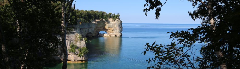
An example of one of the customized maps I created for our 2018 backpacking trip to Pictured Rocks National Lakeshore in the Upper Peninsula of Michigan. This 42 mile trip required twelve 8.5″ x 11″ landscape oriented pages to get the desired level of detail and readability. Having maps with customized details like campsites, daily mileage, and much more was quite valuable on this multi-day adventure.
© Todd D. Nystrom and Todd the Hiker, 2017-2022.
